
East Honolulu Previous Resident Sources
No single roll names all previous residents of an East Honolulu home. The useful trail changes by era. Current parcel systems establish the Tax Map Key, or TMK, and physical address. Recorded instruments show transfers and interests in land. Permits date changes to a structure. Printed directories, census schedules, obituaries, probate files, and old maps can then add people and place context. Coverage is uneven, so a missing result must stay a gap.
| Record layer | Documented span | Access point | Best evidence |
|---|---|---|---|
| BOC online index | Generally 1976 to present | Bureau of Conveyances portal | Parties, instrument, date, and document locator |
| Historical deeds and indexes | 1845/46 to 1916, series varies | FamilySearch and BOC reference room | Grantor, grantee, book/page, and land description |
| Honolulu directories | 1880s through later twentieth-century runs | State Archives, UH, FamilySearch | Time-stamped names, work, business, and address lines |
| Territorial census | 1866, 1878, 1890, 1896, incomplete | Hawaii State Archives | Named schedules where surviving geography permits |
| DPP permits | Legacy data through July 28, 2025; newer files in HNL Build | POSSE, HNL Build, or DAIB request | Applications, approvals, plans, and dated alterations |
For a recent transfer, begin with the TMK and BOC. For a twentieth-century occupant, use a dated street section and then the alphabetical directory entry. Earlier work may need the State Archives, UH collections, BOC reference room, newspapers, or a written request. East Honolulu is a Census-designated place, not an incorporated city, so older records may be filed under Honolulu, Maunalua, or Koolaupoko.
Start East Honolulu Resident History
Capture the address exactly as shown, plus the TMK, TaxPIN, parcel UID, recorded area, building details, and record date. Honolulu Real Property Assessment can supply current and historical assessments, classification, lot and building descriptions, living area, rooms, exemptions, and appeal information. Honolulu GIS adds the physical address and map context. Owner, lessee, tax mailing address, and occupant are distinct concepts.
The Honolulu real-property portal is the current assessment starting point. Its official field guide was inspected, but the research did not retrieve a stable live East Honolulu parcel card. Record only fields visible in the result. The current snapshot anchors later evidence; it does not itself identify previous residents.
East Honolulu Resident Permit Clues
A permit can date a new structure, addition, address change, subdivision, or major repair. The legacy DPP POSSE search displays data only through July 28, 2025 at 5 p.m. New permit applications moved to HNL Build on August 4, 2025, while historical migration continues. Search both systems before treating a quiet result as no work.
Full plans and older image files may require DPP Data Access and Imaging. Ask for one TMK, record class, and date range. Permit applicants and owners named in a file are not always the people who occupied the property. Use the dates to shape the house chronology, then verify names elsewhere.
Walk East Honolulu Resident Deeds Backward
Hawaii records land statewide through the Bureau of Conveyances, not a Honolulu County recorder. A chain of title is the linked sequence of recorded interests in the same land. It is useful evidence, but the BOC index is not a legal title opinion. Match the TMK and land description, not just a street address or common name.
- Record the current parcel key and legal description from assessment or GIS. Keep the source date.
- Find the present party's acquisition instrument in the BOC index. Confirm the document type, date, and locator.
- Search the transferor as an earlier grantee, while checking the same land description and TMK.
- Repeat the link. Separate deeds from mortgages, liens, releases, leases, and Land Court orders.
- For pre-1976 material, use the BOC reference room or written search route, then inspect the original page.
- Grantor and grantee
- The grantor transfers an interest; the grantee receives it.
- Chain of title
- The linked sequence of recorded transfers or interests for one tract.
- Legal description
- The land description used in instruments. It can remain useful when the street name or number changes.
East Honolulu Resident Document Eras
Old BOC citations do not all look alike. Older Regular System records use liber, or book, and page. Records from 1990 through 2011 generally use a year plus document number. The system used eight digits from 2012 through July 31, 2024, then ten digits from August 1, 2024. Land Court documents use a T followed by up to seven digits.
That small formatting fact can rescue a stalled previous residents search. Entering an old book/page reference as a modern number may return nothing even when the instrument exists. The BOC online-services page explains current access, while reference-room staff and the written form cover older work.
East Honolulu Resident Census Gaps
The territorial census is not a complete East Honolulu address roll. Surviving Hawaii returns exist for only 1866, 1878, 1890, and 1896, and coverage is incomplete. The 1878 Oʻahu schedule does not cover the East Honolulu side; 1890 includes only limited Koolaupoko material. A blank search is therefore a source gap, not proof that a family was absent.
The State Archives census collection shows the scope and limits:
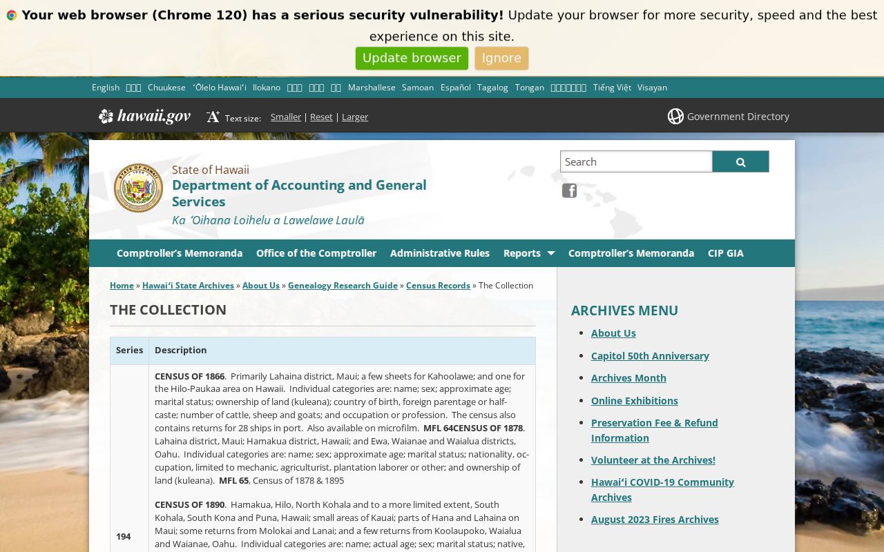
The captured collection page is valuable because it makes missing geography visible instead of inviting guesses about past residents.
Maunalua Changed East Honolulu Addresses
East Honolulu house history has a landscape problem that records alone cannot smooth away. After development rights were granted in 1959, Kuapa Fishpond was dredged and reshaped into the Hawaiʻi Kai Marina and peninsula system. Roads, fills, subdivisions, permits, and modern parcel lines followed through the 1960s. A present parcel may sit on land that had no matching house number in an older directory.
Compare the current TMK with the UH Maunalua historical mosaics and the official environmental history. Preserve the old place term when a source says Maunalua, Kuapa, or Koolaupoko. The right question may shift from who lived here before to what land, water, road, or tract existed before this address.
Archives Extend East Honolulu Resident Trails
When a name drops from the deed or directory chain, obituary, probate, marriage, and vital-statistics indexes may explain the next move. Hawaii State Archives holds an obituary index covering 1836 through 1950 and historical Oʻahu vital-statistics series through 1929, with gaps and varied record types. Early items may be reports, licenses, stubs, or indexes rather than complete certificates.
The State Archives vital-statistics guide shows those holdings:
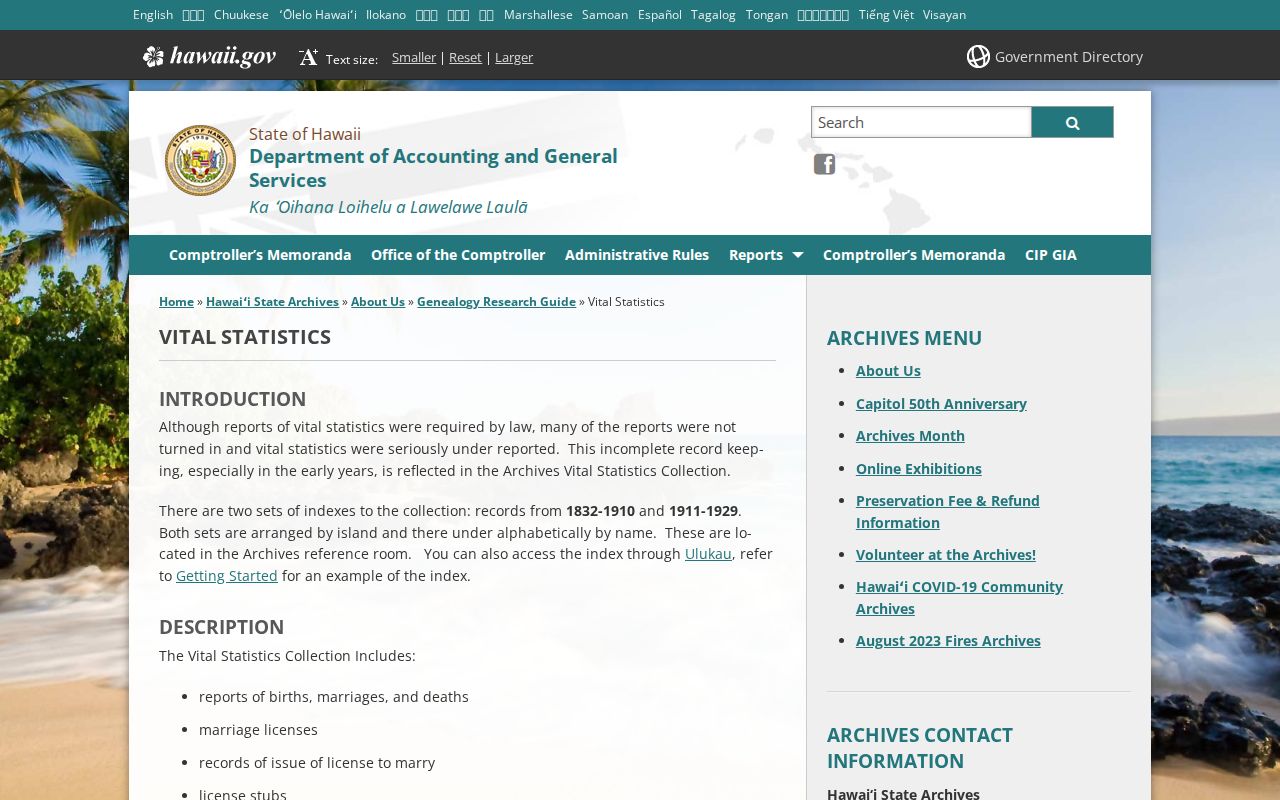
This archival layer can corroborate an old resident, but it should be cited by record type, date, repository, and page rather than treated as a current address file.
Confirm East Honolulu Past Households
Ownership is only half the past residents question. Historical Honolulu directories may list a printed name, occupation or business, and residence, with separate alphabetical, classified, and street sections. Start with an address and year, inspect the page image, follow the name entry, then check another year. The full publisher and repository runs belong on the East Honolulu city directory page.
Use this flow: address and year → street section → name entry → nearby directory year → surviving census schedule → obituary or probate cross-check. Keep the directory year and printed page with every extract. Do not convert an office address, owner name, widow notation, or abbreviation into a complete household claim.
Lawful use. Research previous residents for house history, genealogy, or estate work. Never use an old or current address to track, expose, or harass a living person.